Local Geology
The ground under Rutherford County
Every foundation decision here traces back to two facts: how deep the limestone is, and how much the clay above it changes size. Both are published, both are free to look up, and neither matches the assumptions in national advice.
There is an unusual amount of public data about the ground under this county, and almost none of it makes it into a foundation conversation. The USGS has mapped the bedrock. The USDA has mapped the soil to the level of individual parcels and published the shrink-swell number for each series. NOAA has thirty years of rainfall normals from a station five miles north of town. Read together, they explain more or less everything a foundation does here.
The basin, and how it got here
Murfreesboro sits in the Central Basin, and specifically in the Inner or Nashville Basin, which is the city's own description of its setting. The basin exists because crustal movement roughly 450 million years ago lifted a broad dome of sedimentary rock, the Nashville Dome, and the fractured rock at the crest of that dome then eroded faster than the flanks did. What is left is a low basin of ancient limestone ringed by the higher Highland Rim.
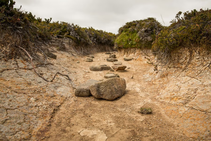
The practical consequence is that this is not the top of a thick soil profile. It is a scoured basin floor with a thin residual skin of clay over hard rock, and the deeper, cherty, silty soils people associate with Middle Tennessee belong to the Rim outside the county rather than to the basin inside it.
What the geologic map says
USGS mapping of surface bedrock across Rutherford County breaks down roughly as follows:
- Ridley Limestone, about 52 percent. Thick-bedded brownish-gray limestone, fine grained, slightly cherty, ninety to a hundred and fifty feet thick.
- Lebanon Limestone, about 27 percent. Thin-bedded gray limestone with calcareous shale partings, eighty to a hundred feet thick.
- Carters Limestone, about 11 percent. Fine-grained yellowish-brown limestone, thin-bedded above and thicker-bedded below, containing thin bentonite beds.
- Bigby-Cannon Limestone and Hermitage Formation, about 6 percent.
- Pierce and Murfreesboro Limestones, about 2 percent.
Add the Stones River Group units together and roughly ninety percent of the county's surface bedrock is one family of Ordovician limestone. These are among the oldest sedimentary rock exposures in Tennessee, and their behavior matters because limestone is soluble.
Karst, in the city's own words
The City of Murfreesboro defines karst as the dissolution of limestone over time by slightly acidic water, creating underground fissures, caves, sinking creeks, sinkholes and springs, and describes what lies beneath the city as a system of moving water and caves that functions like a plumbing system, with water traveling through cracks and seams as though they were pipes. The Park Service records the same landscape at Stones River National Battlefield: sinkholes, caves, underground drainage, alluvium along the West Fork corridor, and thin soils between bedrock exposures.
For a homeowner the useful takeaway is not drama about sinkholes. It is that groundwater here does not necessarily behave the way surface topography suggests. Water can travel laterally along and within the rock and emerge somewhere that has no obvious uphill catchment, which is why a damp wall is sometimes fed from a long way off. That is covered further in the water management guide.
How deep is the rock
The USDA soil survey answers this parcel by parcel. Across Rutherford County, the depth at which soil surveyors record a lithic bedrock restriction ranges from roughly ten inches to over six feet depending on the series:
- Gladeville: 25 to 50 cm, about 10 to 20 inches
- Dilton: 41 cm, about 16 inches
- Barfield: 46 cm, about 18 inches
- Talbott: 76 cm, about 30 inches
- Eagleville: 89 cm, about 35 inches
- Bradyville: 122 cm, about 48 inches
- Mimosa: 140 to 165 cm, about 55 to 65 inches
- Tupelo: 165 to 200 cm, about 65 to 79 inches
The county's single largest map unit is the Gladeville and rock outcrop complex on slopes of two to fifteen percent, covering 93,215 acres. Bare rock outcrop is itself a mapped major soil component on about 10.8 percent of the county, around 43,000 acres. Gladeville alone accounts for 14 percent, Talbott 11.4 percent, and Bradyville 9.2 percent.
Linear extensibility, and why it keeps coming up
Shrink-swell is not a vague adjective in soil science, it is a measurement. The NRCS defines linear extensibility as the change in length of an unconfined clod as moisture content is decreased from a moist to a dry state, expressed as the volume change between the clod at one-third or one-tenth bar tension and oven dryness, reported as a percentage for the whole soil, with the amount and type of clay minerals present driving the result.
Here is what the survey records for Rutherford County series, as maximum linear extensibility and maximum clay content:
- Ashwood: 9.6 percent, clay to 56 percent. Taxonomically Vertic Argiudolls.
- Mimosa: 9.2 percent, clay to 60.5 percent. Formed in clayey residuum from phosphatic limestone.
- Dowellton: 7.5 percent, clay to 67.5 percent. Very-fine, Vertic Ochraqualfs.
- Eagleville: 7.5 percent, clay to 47.5 percent. Classified montmorillonitic.
- Roellen: 7.5 percent, clay to 50 percent. Both montmorillonitic and Vertic.
- Barfield: 7.5 percent, clay to 45 percent.
- Bradyville: 7.1 percent, clay to 66 percent.
- Talbott: 4.5 percent, clay to 50 percent.
- Gladeville: 3.5 percent, clay to 55 percent.
- Harpeth: 1.5 percent, clay to 36 percent.
Two labels in that list do a lot of work. Vertic is a taxonomic prefix that USDA Soil Taxonomy applies specifically to soils showing shrink-swell and cracking behavior, and three Rutherford County series carry it. Montmorillonitic means the clay mineralogy is dominated by smectite, the most expansive clay mineral group. Neither is marketing language; both come out of the classification itself.
Looking up your own address
None of this has to be taken on trust. The USDA operates the Web Soil Survey, a free public tool where you draw a box around your property and it returns the mapped soil series, the depth to any bedrock restriction, the hydrologic group, and the linear extensibility. It takes about five minutes and it tells you more about why your house behaves as it does than any single site visit will.
Two cautions on reading it. First, soil mapping is at survey scale, so it describes the typical condition of a map unit rather than a guaranteed profile under one specific footing. Second, a high linear extensibility number is not a verdict on your house; enormous numbers of houses sit happily on high-shrink-swell soils where drainage keeps the moisture content stable. The number tells you what the soil is capable of, and drainage decides whether it gets the chance.
Alluvium along the rivers
One more setting is worth separating out. The Park Service records alluvium, meaning unconsolidated gravel, sand, silt and clay deposited by water, along the West Fork Stones River corridor. Alluvial ground behaves differently from the residual clay uplands: it was laid down by moving water rather than weathered in place, so it varies both across short distances and with depth. A footing bearing partly on a firm layer and partly on a soft lens is the textbook setting for differential settlement, and it is not something you can see from the outside of a house.
Putting it together
Thin soil over an irregular rock surface produces uneven bearing. Clay with genuine volume change in it works that bearing seasonally. A rainfall record that swung from 40.36 inches in 2007 to 70.72 inches in 2020 supplies the moisture cycle. That is the whole mechanism, and it explains why so many houses here show movement without anyone having done anything wrong.
It also explains why drainage is the highest-value intervention available on most lots. You cannot change the soil and you cannot change the rock, but you can decide how much water reaches them.
Want the ground at your address looked at properly?
Ring (615) 410-4690, or send the quote form and somebody will ring you. Free either way.